Drone technology has rapidly changed in the last few years, as have the rules around where you can fly. Here's how to get the best out of taking photos from above.
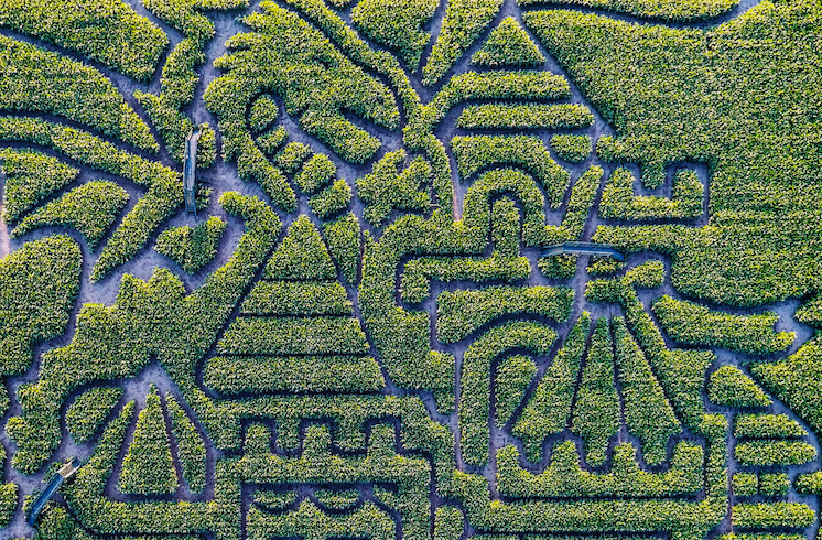
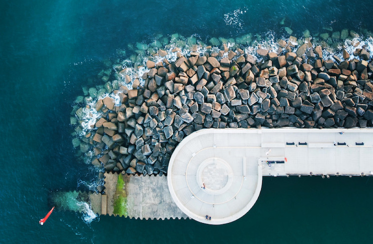
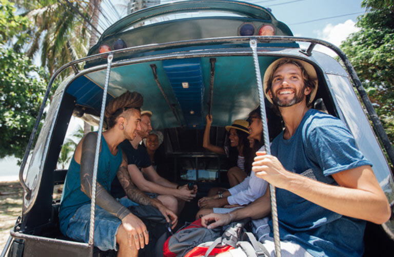
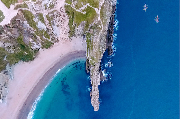 Photo © Ryan Howell
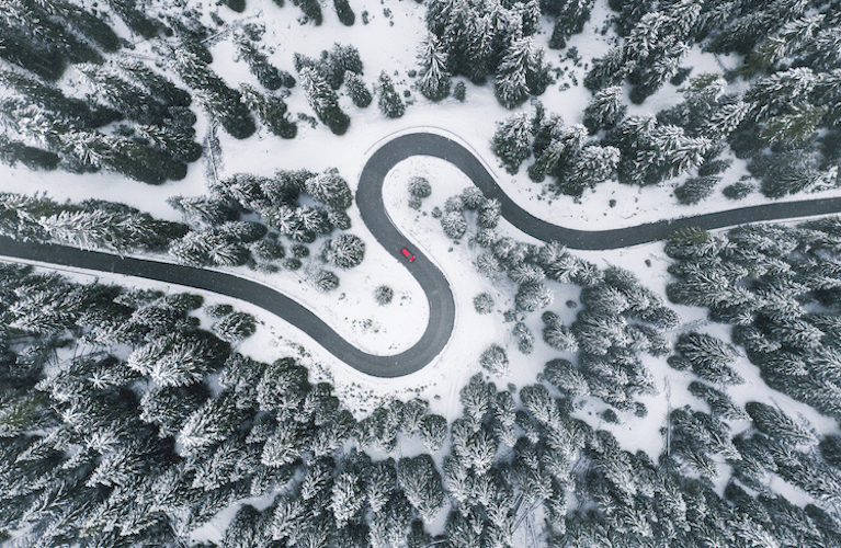
When I wrote an article in 2017 about drones, I flew a DJI Phantom 4 drone, one of the larger white quadcopters that have become synonymous with drones. It went everywhere with me and needed its own backpack. Over the last four years, technology has changed and now I have a drone that fits in the palm of my hand. As technology has improved and changed, the popularity of drones has increased, and they have become more affordable. The drone I have now cost just a third of what my previous drone did, yet it is just as capable. With all these changes and some high-profile drone incursions and incidents, the rules have changed too.
When traveling with a drone, here are some things you need to consider.
Do you need a licence?
This depends on a number of factors and will depend on the country you intend on flying in. It’s always advisable to check with the relevant Aviation Authority to be sure. In the UK and the USA, for example, almost all drones/operators need to be registered and display the registration/operator number on the aircraft.
In both the UK and the USA, the magic number in terms of your drone’s weight is 250g. The rules differ depending on the weight and your intended use of the drone, but aircraft under 250g in weight have the least rules and restrictions.
Registration comes at a cost, in the UK it’s currently around £9 and in the USA, it’s around $5.
You must always adhere to local ‘drone codes’, privacy rules and laws and, always, fly safely.
Flying a drone in an unsafe manner will land you in trouble with the Aviation Authority and this can and does result in large fines and the real threat of prison.
Check if you need a licence/registration/operator ID:
(UK) https://register-drones.caa.co.uk/drone-code
(USA) https://www.faa.gov/uas/getting_started/register_drone/
(Europe, by Country) https://www.easa.europa.eu/domains/civil-drones/naa
Staying safe
As indicated above, the rules you must adhere to depend on the drone you are using and what you are doing, but there are some rules that apply to almost all flights, in almost all countries. In when deciding if you are flying safely, these rules (which are part of the UK Drone Code) are a good measure:
- Keep your drone within Visual Line Of Sight (VLOS)
- Don’t fly above 120m (400ft) from the Earth’s surface
- Stay at least 50m from people (and don’t fly over them)
- Stay at least 150m from residential, recreational, commercial and industrial areas
- Never fly in an airport’s Flight Restriction Zone (FRZ)
The onus is always on the aircraft operator to ensure every flight is safe and within the rules.
The more things you can do to make sure your flight is as safe as possible, the better position you’ll be in if something does go wrong. I call it due diligence.
Plan ahead
I used to fly aimlessly on location, hoping that I would see something worth photographing. I’d get lots of flight time in, but I wouldn’t be entirely happy with the photos. If you invest time before going on location with your drone, you’ll find that your flights are more productive, and you achieve more in less time. Average battery life is around the 20-25-minute mark, so the more you can do without changing batteries, the better.
When I reach the location now, I know exactly where I’m going to take off and land from, I know where the sun will be, I know about any hazards (pylons, cliffs, airports etc) and I know specifically what I’m going to photograph. I tend to use 50% of the battery and I’m done. I come away from flights now with three times as many photos.
These are some really useful apps for planning flights:
Altitude Angel is an app that allows you to see details of restricted flight space, NOTAMs (Notices to Airmen) and other information that relates to hazards and airspace information. This app also lets you log a drone flight, always a good idea, and see drone flights logged by other pilots. Altitude Angel will also email you a pre-flight report, showing you location-specific information, great for that ‘due diligence. This app works for many countries across the World.
Advisory lets you check the weather, in detail and my favourite bit of this app is the ability to see exactly where the sun will be at any given time. Knowing where the sun (and light) will be, is a really important factor when planning for photography.
UAV Forecast lets you check lots of factors that help you decide wherever you should fly or not, the wind speed, cloud cover, chance of rain, location of airports and how many satellites your drone may connect to. You can set the limits in this app to match your drone or local rules.
Google Earth is the best app for exploring the terrain of your flight location. I use it in 2D and 3D modes to get a real feel for what I can expect when I arrive on location. I know if there’s a hill to climb or avoid. I decide where I’m going to set up my take-off and landing by using Google Earth. I’ve stumbled across some great photo opportunities from just browsing Google Earth.
Make your work different
If you fly a drone and take photos, then you’re an aerial photographer. There are millions of you. By following the planning advice above, you’ll make sure you know what it is you want to photograph before you even touch the flight controller. This will increase your chances of finding that one image that no one else has taken or seen.
Only share your best work – You’ll take several photos, but one will be the best. Only share that one photo, archive the rest. You want people to see your best photos, no one likes mediocre.
Rotate it – Sometimes I take a photo and something doesn’t feel quite right. Try rotating the photo a few times, you’ll be surprised how different you’ll feel about it.
Nadir is best – A photo of the lens looking directly down on your subject often gives a very unique perspective. These shots, referred to as nadir, will stand out, because it’s a view people aren’t used to seeing.
Perspective – Try to include something in your photo that gives its viewer an idea of scale. Sometimes aerial photos can be underwhelming because it’s not clear how amazing the photo really is. Include something that everyone can relate to the size of.
Don’t be afraid of the water – Fly over water, it’s scary for the first few (hundred) times, but waves look fantastic from above. You should ensure that your drone isn’t set to automatically land if it loses connection, instead have it return to the take-off point unless that’s a boat that’s on the move.
My final word will be on the impact of the recent travel restrictions, it’s forced me to go out in my local area, places far closer to home, and explore. Don’t underestimate what’s right on your own doorstep, all flights increase your experience and you’ll find some hidden gems just down the road.
You live where others travel.
Related articles
Simple and flexible travel insurance
You can buy at home or while traveling, and claim online from anywhere in the world. With 150+ adventure activities covered and 24/7 emergency assistance.
Get a quote
No Comments