Called the most beautiful scenic route in Thailand, the Royal Coastal Route leads to places well-known as well as off the beaten track. Traveling during a pandemic means you can enjoy it free of crowds. Nomad John shares his experience.
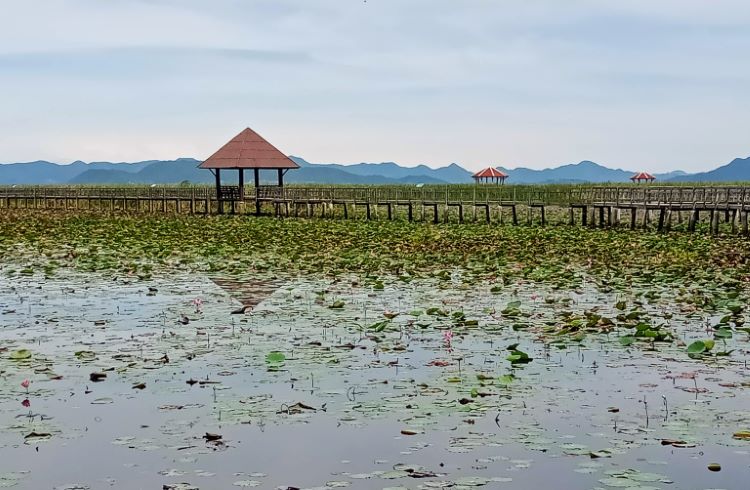 Photo © John McMahon
As I make a left-hand turn off the traffic-choked, six-lane, Rama II Road, onto the two-lane Royal Coastal Route (RCR), about an hour south of Bangkok, the stress of competing with double-trailer trucks and lane-splitting motorcycles falls away.
Conceived of more than a decade ago, the RCR (which weaves its way south 620mi (1,000km) to the Malaysian border along the Gulf of Thailand) was part of late King Bhumibol Adulyadej’s plan to improve infrastructure in the least-developed parts of the country. It was created by improving already existing rural roadways and connecting them with more than 186mi (300km) of new construction – including dedicated cycling lanes. The department of land management, which oversees the project, calls it the “most beautiful scenic route in Thailand” and promotes the coastal region as the Thai Riveria.
Chang and Eng, famous Siamese Twins
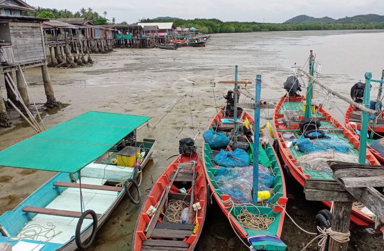
The route begins in historic Samut Sakhon, a city older than Bangkok, where the Mae Klong River (not to be confused with the Mekong) splits into numerous channels before emptying into the Gulf of Thailand. It was here that the conjoined brothers, Chang and Eng, to whom the outdated term “Siamese twins” was first given, were born in the mid-1800s. The brothers toured Europe and North America for more than a decade, regarded as a wonder of nature, before settling down in North Carolina, using their show business money to start a plantation. The brothers married the Bunker sisters and had 21 children between them before their deaths, days apart in 1875. I found an unimposing statue commemorating the town's famous offspring just off the RCR, in a dusty square outside the city's juvenile court building.
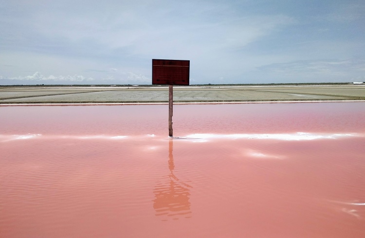
Moving south, the canal bridges give way to sea farms that are flooded and raked to harvest salt. Tons of it, piled and stored in ramshackle wooden buildings, dot this almost surreal landscape. Salt farmers, riding tractors and covered head to toe against the blazing sun, criss-cross the fresh-laid blacktop.
Southwest to Hua Hin
Ban Laem is the first of several popular beach towns leading to the chic resort city of Hua Hin, which caters to visiting travelers, with accommodation ranging from backpacker to luxury and food choices from around the world. Once the preferred home of the late King Rama IX, it hosts a yearly jazz festival in his honor. I stopped here for the night, and found hotel prices greatly reduced and the long golden shingle of Hua Hin Beach, normally crowded with vendors, jet skiers and horse-riding touts, all but empty.
The RCR hugs the coast tightly for another 19mi (30km) as the 300 peaks of Khao Sam Roi Yot National Park come ever closer. The road snakes through the steep limestone formations of the park, stippled with caves and temples. It’s a favorite stretch for cyclists and motorcyclists for its tight corners and long, flat stretches, but use caution as packs of macaque monkeys live among the crags here and pay little heed to human traffic.
The only major interruption to the coastal route is at Ao Manu, or Lime Bay, just outside of Prechuap Kiri Khan city. The bay is popular with families and weekenders for picnics and swimming in its tranquil, shallow waters surrounded by limestone karsts that rise up out of the sea. There’s no through road, since the entire bay is under control of The Royal Thai Air Force’s 5th wing command (and the site of the only battle between Thai forces and the invading Japanese Army during WWII).
I timed my stop here to coincide with a holiday, one of the few days when the challenging hiking trail to the top of Lom Muak Mountain is open. Setting off before the heat of day, the two-hour walk uphill rewarded me with an astounding panorama of the city, bay, and sea beyond.
Chumpon and the south
The road south to the city of Chumphon is one of my favorites in Thailand, as it runs along miles of empty beaches with views of still-unsullied islands just off shore in the turquoise water. The road is fun to drive, with a series of banked, twisty corners and rolling hills.
Chumpom is considered the first city of the south. Small enough to easily walk around, but large enough to offer a good choice of accommodation, shopping, and dining, it’s also the jumping-off point for the islands of the famous Samui Archipelago, including Koh Samui, Koh Pha Ngan and Koh Tao.
Further south, between the ancient capital city, Nakhon Si Thammarat, and the ad hoc capital of the south, Hat Yai, lies Lake Songkla, the largest in Thailand. The lake covers more than 386mi2 (1,000km2) and is dotted with islands large enough to support entire villages. I spent the night on its shores and then hired a boat for an early morning ride through its immense lotus bloom, hoping to spot the endangered Irrawaddy dolphins that live in its waters. The flowers were exquisite, but the dolphins remained unseen.
South of Hat Yai
The RCR essentially disappears as a marked route south of Hat Yai, in the provinces of Pattani and Naratiwat, but it’s still possible to follow the coastline in this area, where Buddhist temples give way to mosques and the call to prayer can be heard in every small town. Once part of Malaysia, and still experiencing problems of assimilation with the rest of Thailand, this area sees few foreign tourists, though visitors from Malaysia are abundant. The food of the true south is different from the rest of the country, and it’s here that I seek out my favorite Massaman curry, made the way it should be – slow cooked and rich with spice and heat.
One of the goals of the RCR is to bring more people, Thai and foreign, to these lesser-known regions. For the curious traveler who wants to see more than just Bangkok and Phuket, or even a long-time resident like myself, the Royal Coastal Route opens a whole gamut of unique destinations to explore in your own way.
Trip notes
The RCR is suitable for cars, motorcycles, and bicycles for long stretches. As the route never wanders very far from population centers, there is no concern about fuel, food, or accommodation. For cyclists, it’s best to take the southern train out of Bangkok as far south as Ban Laem – as the RCR essentially runs parallel to the southern rail line, cyclists can use the train to pick and choose stretches to follow without ever having to ride on the congested and dangerous Highway 4. For those who enjoy roughing it, all of Thailand's National Parks offer tents, and most, very comfortable bungalows for overnighting with safe distancing. Whether going by car or motorcycle, it’s highly advisable to review Thai driving habits before setting off on any trip, as maneuvers unseen in other places are the norm in Thailand.
(Note: Some governments advise against non-essential travel to certain parts of southern Thailand. Check your government's travel warnings before visiting.)
Related articles
Simple and flexible travel insurance
You can buy at home or while traveling, and claim online from anywhere in the world. With 150+ adventure activities covered and 24/7 emergency assistance.
Get a quote
No Comments