Comprising 17 national parks strewn across Patagonia, Chile's Ruta de los Parques (Route of Parks) features some of the most diverse and spectacular scenery anywhere on the planet. Nomad Dave shares five captivating, lesser-visited, and easy-to-access spots.
 Photo © Dave Stamboulis
- Patagonia National Park: A memorial to Douglas Tompkins
- Cerro Castillo: the successor to Torres del Paine
- Pumalin Douglas Tompkins National Park: all things Patagonia
- Queulat National Park: hanging glaciers, evergreen forests, and waterfalls
- Laguna San Rafael: glacier exploration and a visit to the Marble Cathedrals
- Trip notes
Patagonia National Park: A memorial to Douglas Tompkins
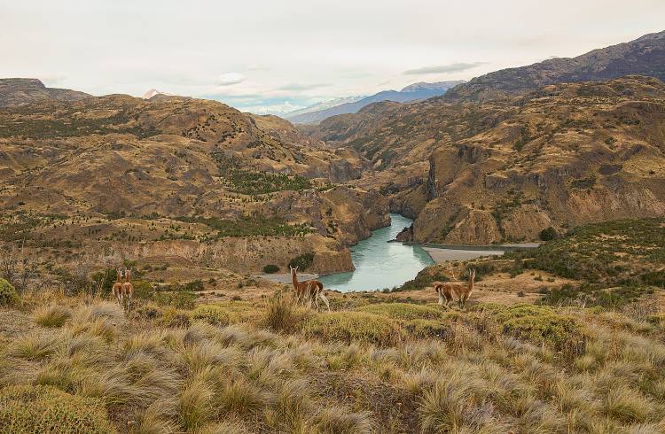
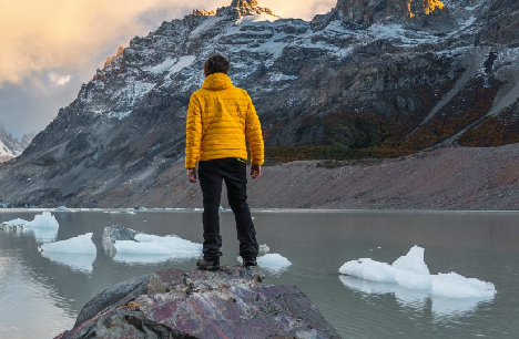
My wife and I stand in awe, taking a respite from our heavy packs and gazing out at the expansive Chacabuco River Valley. Around us, the only inhabitants are guanacos, herds of them by the hundreds, roaming wild in the restored grasslands of Patagonia National Park. It’s one of the latest natural sanctuaries added to the phenomenal Ruta de los Parques, or Route of Parks, a massive green space for Chile and the world, which comprises 17 national parks covering 1,700mi (2,735km) from Puerto Montt to Cape Horn in Chilean Patagonia.
This environmental project got its start via Douglas Tompkins, the former cofounder of The North Face outdoor equipment and clothing company. Tompkins and his wife Kris called Chile home, and as avid conservationists, they began buying millions of acres of over-grazed and overused ranch land in Patagonia, focusing on wildlife recovery and biodiversity protection. Years later, the Tompkins gave away all the land, which had made a full recovery, to the Chilean government, in what was the largest donation in history by a private person to a country.
While Doug Tompkins tragically passed away in a kayak accident in 2015, three years later his wife and the Chilean government finalized a deal for the protection of 28 million acres of land, incorporating them into 17 parks with a size about three times that of Switzerland or double the size of Costa Rica.
Our visit to Parque Patagonia was just one in a series of overnight treks and day hikes as we traveled the thin spine of Patagonia from south to north, checking out as many of the parks of “Las Rutas” as our time and the onset of winter would permit. Here are some of the most captivating, easy to access, and lesser-visited spots along this magical route, which took us through the heart of some of the most diverse and spectacular scenery anywhere on the planet.
Cerro Castillo: the successor to Torres del Paine
While Torres del Paine has long been a scenic icon and the best-known of all of Chile’s parks, its stunning spires and famed “W” circuit have seen an overload of visitors in recent years. Trekkers now need to have all their campsites, lodges, and permits booked well in advance, and as each campsite or lodge is often run by a different concession, it’s both confusing and cumbersome to successfully navigate the hurdles to hike here.
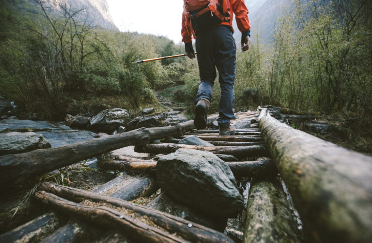
Further north in Patagonia’s Aysen Region, Cerro Castillo offers a fantastic alternative, where a four- to five-day circuit takes you around the breathtaking Cerro Castillo massif, trekking past turquoise lakes, beautiful lengua forests, hanging glaciers, and over dramatic passes, with far fewer crowds than its more famous southern neighbor. We braved an early autumn snowfall here to do the 35mi (56km) trek and were one of just two parties to cross Cerro Castillo Pass after it snowed, making it a far wilder experience than joining the masses in Torres del Paine.
Pumalin Douglas Tompkins National Park: all things Patagonia
We feel like we’re getting all of Patagonia’s top highlights wrapped up in one at this wildly diverse spot. We spend two days hiking up and back on the Ventisquero Trail, where a stunning campsite sits at the edge of a glacier just under Michinmahuida, a crevasse-riddled snowbound volcano that towers up valley. Here we spot a pair of elusive pudu, the world’s smallest deer, before escaping a spell of bad weather for the nearby El Amarillo hot springs, where 100°F (38°C) pools soothe our weary muscles.
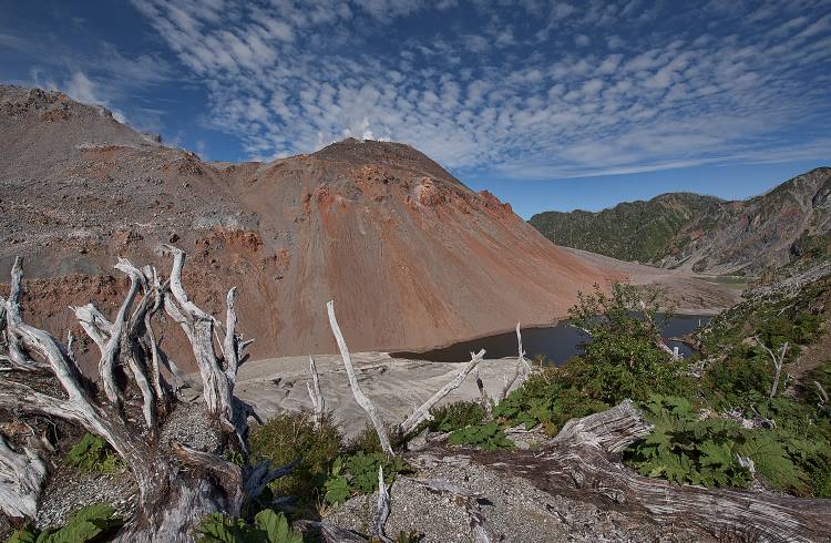
The following day we make the trek up the Chalten Volcano, Pumalin’s highlight, as it’s a living geology lesson. The volcano violently blew its top in 2008, causing the mountain to rise, in what was a one-of-a-kind rhyolitic eruption. Not only does Pumalin offer volcanoes, glaciers, and hot springs, it’s home to gorgeous fjords and 25% of Chile’s remaining threatened Alerce trees, which live for 3000 years.
Queulat National Park: hanging glaciers, evergreen forests, and waterfalls
Raingear stays at the top of our packs in Queulat National Park, which is no surprise, given that queulat means “sound of waterfalls” in the local Chono people’s language. But the persistent wet doesn’t dampen our spirits – it just makes the day hike up to the Ventisquero Colgante glacier all the more riveting, as this emblematic glacier features crashing waterfalls that pour down from its base.
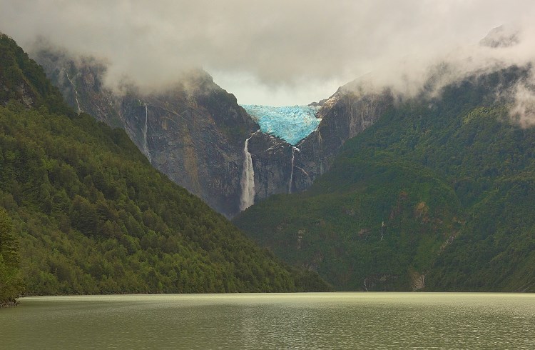
Here we see the rare nalca, or giant rhubarb flower, in the temperate rainforest, and after trekking close to the glacier, come back down for a boat ride on the Los Témpanos lagoon, which gives a wider view of the impressive glacier above. Queulat also sits right near the Ventisquero Sound, home to the pristine Puyuhuapi fjord, featuring hot springs and stunning, remote lodges to rest up in.
Laguna San Rafael: glacier exploration and a visit to the Marble Cathedrals
Many of the Route’s top draws can be found along the Carretera Austral, an 800mi (1,287km), bumpy often-dirt road that runs the length of Patagonia and might just be the world’s greatest remaining road trip. Travelers on the Carretera usually break up their journey in sleepy Puerto Río Tranquilo, set on the edge of Lago General Carrera, the largest lake in Chile, and home to two stunning must-visits.
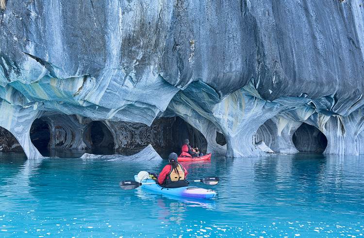
The Capillas de Marmol (Marble Chapels or Marble Cathedrals) are a series of wind-sculpted caves and pillars set on the edge of the lake which feature remarkable patterns and stunning colors, and can be visited by either tour boat or, as we opted for, by paddling ourselves in kayaks. This way, we could access the inner chambers of the grottoes and get intimate with the textured surfaces created by natural geologic process.
Río Tranquilo is also the jumping-off point for Laguna San Rafael National Park, which is home to the massive Exploradores Glacier on Patagonia’s vast Northern Icefield, where guides take modern-day explorers walking on the ice, or one can take a boat on the San Rafael Lagoon and watch the glaciers calve from out on the water.
Trip notes
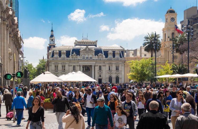
Plan your Route of the Parks visit for the austral summer, which is the North American winter. Patagonia lies below the 40th parallel south and sees freezing winters with heavy snowfall and brutal winds from June to September. Additionally, most services shut down then. Even during high season (December to February), getting around can be challenging. You can fly from Santiago to Puerto Montt in the north, Balmaceda in Aysen (central), or Punta Arenas in the south. There’s an array of private bus services all the way from O’Higgins at the southern end of the Carretera Austral to Puerto Montt in the north, but space is limited, and you may need to reserve at least a few days (or more) in advance.
It’s become a rite of passage for Chilean students to come to Patagonia in the summer months, so transport is often hard to come by. Note that hitchhiking is both common here and about as safe as anywhere in the world, and it’s normal to see loads of travelers with large backpacks lining up along the Carretera Austral as a viable alternative to buses.
Also note that if you go to Torres del Paine, there’s no road linking this part of Chile with the rest of Chilean Patagonia. You’ll either have to go by road through Argentina and then cross back further north, or else cross into El Chalten in Argentina and combine a series of boats and a 14mi (22km) walk in order to reach O’Higgins at the southern end of the Carretera. Being flexible is a must in Patagonia.
You’ll see snow, rain, wind, and every weather condition possible in all the parks here, so bring a waterproof tent and rain gear, as well as gear that can stand up to strong winds.
Chile’s CONAF (the national forest association) now manages all the national parks and each park has its own entry fees and rules (Torres del Paine and Cerro Castillo both have limits on numbers of visitors each day). For all the links to each park and information on the Route of Parks, check the informative Rutas website for the latest information.
Related articles
Simple and flexible travel insurance
You can buy at home or while traveling, and claim online from anywhere in the world. With 150+ adventure activities covered and 24/7 emergency assistance.
Get a quote
2 Comments
Looking forward for a visit
Could you please send a map and route please
Thanks 🙏